Trail Other activity Santa María de Cayón - la penilla-totero - Photo
© OpenStreetMap contributors
Length
Length
12.3 km
Max alt
Max alt
168 m
Uphill gradient
Uphill gradient
147 m
Km-Effort
Km-Effort  
14.2 km
Min alt
Min alt
77 m
Downhill gradient
Downhill gradient
147 m
Boucle
Boucle
Yes
Creation date :
2017-02-20 00:00:00.0
Updated on :
2017-02-20 00:00:00.0

(0 Reviews)

Other activity
Other activity
2h42
Difficulty : Easy

Scan this QR Code to open this trail in the SityTrail application

FREE GPS app for hiking

Logo SityTrail SityTrail

IGN / Geographical institutes

Download SityTrail from the App Store Download SityTrail from Google Play

Logo SityTrail SityTrail World

The world is yours!

Download SityTrail from the App Store Download SityTrail from Google Play Download SityTrail on Huawei AppGallery

About

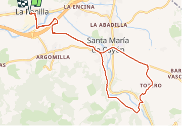
Trail Other activity of 12.3 km to be discovered at Cantabria, Cantabria, Santa María de Cayón. This trail is proposed by soniadiaz30.

Elevation profile

Positioning

Country:
Spain
Region :
Cantabria
Department/Province :
Cantabria
Municipality :
Santa María de Cayón
Location:
Unknown
Start:(UTM)
428468 ; 4796469 (30T) N.

Trails nearby

Trail Walking Villaescusa - parc - Photo
Walking
yves65

Walking

Easy
Villaescusa, Cantabria, Cantabria, Spain
13.9 km | 21 km-effort
2h 55min
No


Close
My subscriptions